Narrowing In on Infill Lots
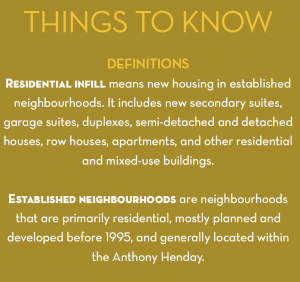
Monday, April 27th, 2015A regular focal point of municipal discussion, and oft mention topic here on the blog, has been the City of Edmonton’s Evolving Infill project.
The aggressive program has made great strides to effectively amend municipal zoning bylaws to make infill projects a desirable and efficient an option as possible for homeowners, investors, and developers. In the face of a skyrocketing population quickly running out of options for private residences, the city has allotted a great deal of resources to what they see as their primary solution to this major issue facing the city’s residents. Creating allowances for higher density options in established neighbourhoods is seen as more viable than costly urban sprawl around the city’s borders.
The most recent stage in the progression of the project has been an easing of zoning regulations for the narrowing of lots. New regulations will allow for land in RF1 zoned areas to be parcelled into smaller widths than previously allowed, to a minimum of 7.6 M (25 feet). According to edmonton.ca:
“The Single Detached Residential (RF1) Zone provides for small scale housing, such as single detached houses, semi-detached and duplex housing. The RF1 zone is the least dense among standard residential zones and found across throughout Edmonton”
The focus has been on lower density zoned areas, as they have the most potential for future expansion to create more residential space. Other zoning changes recently approved by city council have included that of garage and garden suites. Slackened laws now permit these types of residences to be built at “any location on a street in residential areas”.
According to city statistic, there are 54,833 lots with appropriate RF1 zoning that meet the criteria for subdivision into narrower lots, all within mature and established city neighbourhoods. The city of Edmonton has provided maps detailing the lots within each area’s neighbourhoods that are eligible, here are the Central, Northwest, Northeast, Southwest, and Southeast maps provided by the city for development research. Each area can be clicked on to see a more detailed, neighbourhood level plan.


